

BOZEMAN – Another Pacific storm is developing off the west coast lifting into the Pacific NW. Ahead of this system a stronger SW flow aloft is expected to keep temperatures running 10 to 15 degrees above normal for SW Montana this weekend.
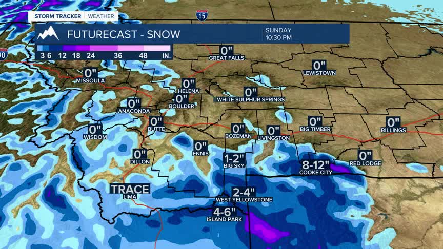
There is a chance for scattered mountain snow showers Saturday night into Sunday morning especially for the southern half of Beaverhead, Madison, and Gallatin Counties. Accumulating snow is possible from Monida Pass over to West Yellowstone and into Island Park, ID Saturday evening into Sunday morning.
A gradual cooling trend will begin early next week with temperatures dropping to near normal levels by the end of next week. This cooling trend could also produce a few snow showers.
