


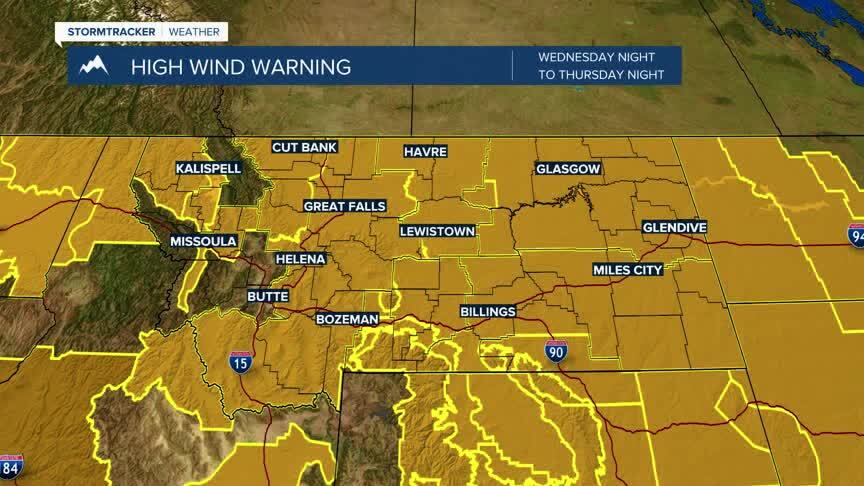
EXTREME WIND ACROSS MONTANA: Winds between 35 mph to 55 mph are likely Thursday with gusts that could approach 70 mph or more through the afternoon across western and southwestern Montana this afternoon and evening.Damaging winds could blow down trees and power lines. High profile or light weight vehicles could have difficult driving conditions as well as blowing dust or snow reducing visibility.The most intense winds are expected through 2-3 PM Thursday afternoon.
WINTER STORM WARNINGS: Winter Storm Warnings are in effect through 6 PM this evening.Heavy snow at high elevations is expected and could create extreme winter weather impacts.Total snow accumulation between 10-20 inches are possible for MacDonald Pass and Georgetown Lake with 1”-6” possible in lower elevations.Visibility will be an issue throughout the evening.

Today's Forecast: Winds in excess of 60 mph are possible today with high mountain snow likely in western Montana and rain/snow mix for valleys.Use caution if driving in these conditions today and expect visibility to drop significantly if rain or snow showers blow into the area. Highs are expected to be in the 40s to near 50° today.
BOZEMAN: High: 49; Low: 38. Extreme wind gusts are expected in excess of 60 mph.Temperatures will be consistently in the 40s today with spotty rain showers and the possibility of a few snowflakes by the evening.Limited accumulation of snow is likely in the Gallatin Valley.
BUTTE: High: 41; Low: 36. Wind will gust more than 50 mph through the afternoon with spotty rain and snow showers likely.Snow is possible though we will likely see little accumulation (1”-2”) during the overnight hours.
DILLON: High: 51; Low: 41. Gusty winds are expected to dominate the forecast for Thursday with spotty rain showers likely.Use caution if you are driving today as downed tree limbs and power lines are possible.
WEST YELLOWSTONE: High: 45; Low: 32. Gusty winds and spotty showers are likely today with no snow accumulation expected throughout the daytime hours.Light snow is possible tonight as our system drives across the region through Friday.

Snow is expcted to be minimal through Saturday morning for most valley locations with heavy wet snow expected in high elevation terrain.
