

BOZEMAN – The next weather maker is currently hitting the Pacific NW coast and should begin to push into western Montana by Wednesday afternoon.
Look for increasing clouds and wind throughout the day Wednesday as a cold front approaches from the west.
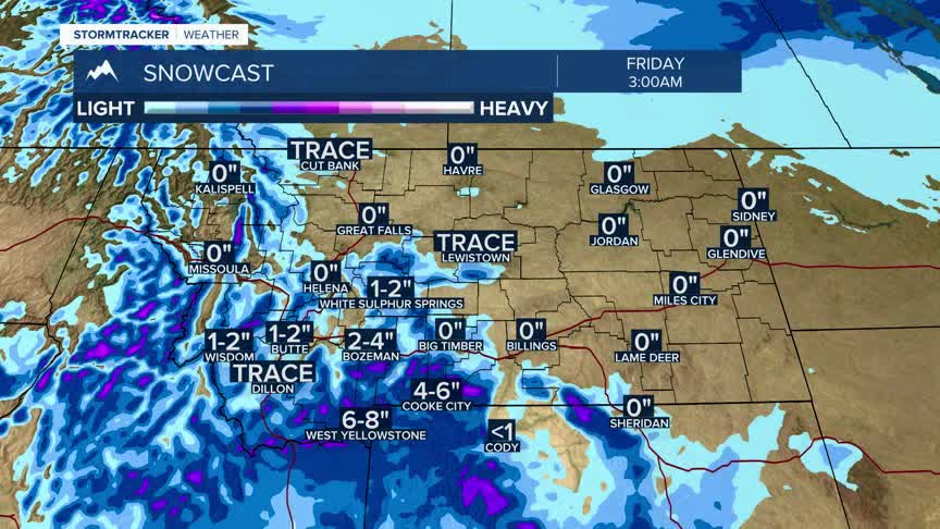
Wednesday evening into Thursday morning there will be increasing moisture with this Pacific storm with a rain/snow mix possible for lower elevations Thursday morning and a good chance for accumulating mountain snow.
The area for possible moderate snow accumulations will be from Eastern Idaho up into the southern tip of SW Montana. West Yellowstone area could see around 6” of snow by Friday morning. The Madison, Gallatin, Absaroka-Beartooth and southern Centennial Ranges will see moderate to heavy snow at higher elevations from this storm.
