

BOZEMAN – Finally, a blast of snow and cold will impact Montana Monday night through the end of the week.
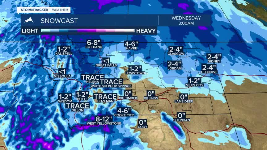
There are winter weather highlights up across the western half of Montana including SW Montana.
A Winter Weather Advisory has been issued Monday night through Tuesday night for SW Montana. West of the divide the advisory includes valleys and mountains but east of the divide the advisory is mostly for mountains and passes.
Accumulating snow, areas of blowing snow are possible Tuesday and a possible early rain/snow mix for some lower valleys. Regardless of precipitation type,look for wet roads to become icy with areas of blowing snow.
West to SW wind20 to 50 mph is possible across SW Montana as a cold front passes through Tuesday morning.
There could be short bursts of heavy snow along with gusty winds creating very low visibility travel hazards Tuesday morning.
Snow and wind should slowly diminish by Tuesday evening.
Scattered mostly mountain snow is likely to continue Wednesday through Friday.
