

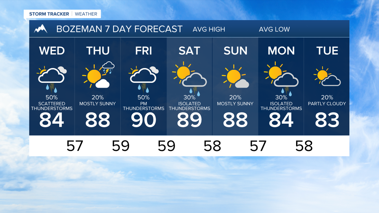


BOZEMAN — Showers and thunderstorms will continue to develop over Southwest Montana, Some storms are capable of severe hail, damaging winds, and heavy rainfall. While the greatest severe threat shifts north and east into Central Montana tonight, Southwest Montana remains in a moist and unsettled pattern with daily storm chances continuing through the weekend.
TUESDAY NIGHT
Some storms may become strong, producing large hail, damaging wind gusts, and localized heavy rainfall. Localized flash flooding is also possible, especially in areas that receive repeated rounds of heavy rain.
WEDNESDAY
A cooler and somewhat cloudier day is expected across Southwest Montana as abundant moisture remains in place. Temperatures will settle closer to seasonal averages. While widespread severe weather appears less likely, scattered showers and thunderstorms remain in the forecast, particularly during the afternoon and evening. Heavy downpours will remain possible with any storm due to the unusually moist atmosphere.
THURSDAY
The unsettled pattern continues with another round of afternoon and evening showers and thunderstorms. Confidence in exact storm coverage and timing remains lower, but sufficient moisture will support locally heavy rainfall. Temperatures remain near seasonal norms.
FRIDAY
Southwest Montana stays under a moist and active weather pattern. Expect partly to mostly cloudy skies with scattered afternoon and evening thunderstorms. While widespread severe weather is not anticipated, stronger storms could still produce gusty winds, frequent lightning, and brief periods of heavy rain.
SATURDAY - MONDAY
Little change is expected. Moisture circulating around the western edge of the central U.S. ridge will continue to fuel daily shower and thunderstorm development. Outdoor activities may be impacted by periods of lightning and locally heavy rainfall during the afternoon and evening hours.
