

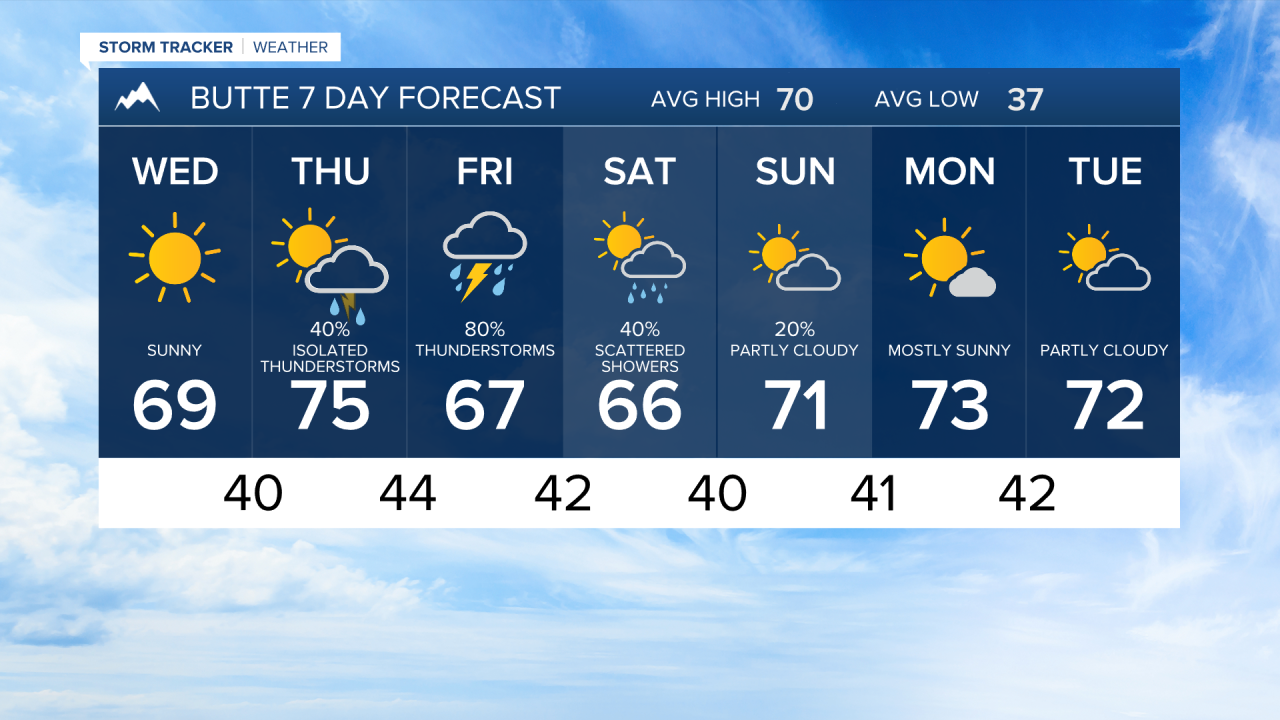


BUTTE — A quiet and pleasant stretch continues through Wednesday across southwest Montana, but a significant pattern change arrives later this week with warmer temperatures, increasing thunderstorm chances, pockets of heavy rain, and a few potentially strong storms near Butte, Bozeman, and along the I-90 corridor before drier weather returns late in the weekend.
TONIGHT
Partly cloudy skies prevail across Butte, Bozeman, Dillon, and surrounding southwest Montana. Most of the region remains dry, while rain showers stay confined to far northern Montana near the Canadian border. Overnight temperatures fall into the 40s with cool valley conditions.
WEDNESDAY
A beautiful late-summer day across southwest Montana. Weak high pressure provides dry weather, a mix of sun and clouds, and seasonable temperatures. Outdoor conditions will be favorable across the region with highs reaching the upper 60s to lower 70s.
WEDNESDAY NIGHT
Clouds gradually increase as a storm system over the Pacific Northwest begins moving east. Southwest winds aloft strengthen, but most locations remain dry overnight.
THURSDAY
The weather begins turning more active. Temperatures warm into the 70s and scattered afternoon and evening showers and thunderstorms develop across southwest Montana, including the Butte and Bozeman areas. While widespread severe weather is not expected, some storms may produce strong and erratic wind gusts due to very dry air near the surface.
FRIDAY
The most active day of the forecast period. A stronger southwest flow brings warmer temperatures along with numerous showers and thunderstorms. Storms developing along and south of the I-90 corridor may become stronger, producing gusty outflow winds and locally heavy rainfall. Moisture levels are projected to be unusually high for mid-September, increasing the risk for brief periods of heavy rain around stronger thunderstorms.
SATURDAY
Showers and thunderstorms continue into at least the first half of the day as the slow-moving upper low tracks across Montana. Coverage gradually decreases during the afternoon, with improving conditions developing from west to east. High temperatures remain comfortable, generally in the upper 60s to low 70s.
SUNDAY
A noticeable improvement arrives. Sunshine becomes more prevalent, precipitation ends, and temperatures begin a warming trend.
MONDAY
Dry and warmer conditions continue as high pressure strengthens over the Northern Rockies. Highs climb back into the 70s with mostly sunny skies, providing excellent conditions for outdoor activities and travel.
