

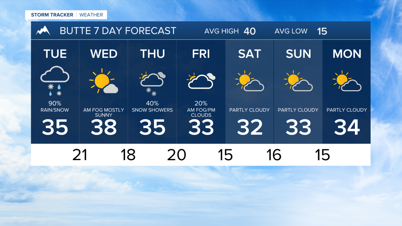


BUTTE — A Winter Weather Advisory is in effect for the Butte/Blackfoot Region starting at 11:00 AM Tuesday through 5:00 AM Wednesday. No accumulation is expected before midnight.
There is a 90% chance of rain and snow bringing around a quarter inch of liquid equivalent through Tuesday, and as snow levels drop as the storm deepens mean that mix could transition to all snow by afternoon. Precipitation eases Tuesday evening but stays in play at around 70%, adding a few hundredths of an inch more. T
Temperatures fall overnight into the low 20s by early Wednesday as wind chills drop to the upper teens, so cover exposed skin and watch for patchy ice on bridges and overpasses as that freeze-thaw cycle sets in.
The extended forecast shows Wednesday clearing out with highs near 38°F before a secondary system arrives Thursday into Friday, keeping temperatures 3 to 5 degrees below the seasonal average.
Snow flurries and the chance of morning fog linger Friday. The pattern stays cool and mostly dry through the weekend with highs holding in the low 30s, a few degrees below normal, before a modest warm-up returns by next Wednesday.
