



BUTTE — A Winter Weather Advisory is in effect through 5:00 AM Wednesday, and light snow is bringing visibility down to 2 miles at times. Precipitation chances run around 80% through midnight, with snow accumulating 1 to 3 inches by morning.
Bitter cold moves in overnight, with wind chills dropping to the lower teens, so cover any exposed skin if you have to be out before dawn.
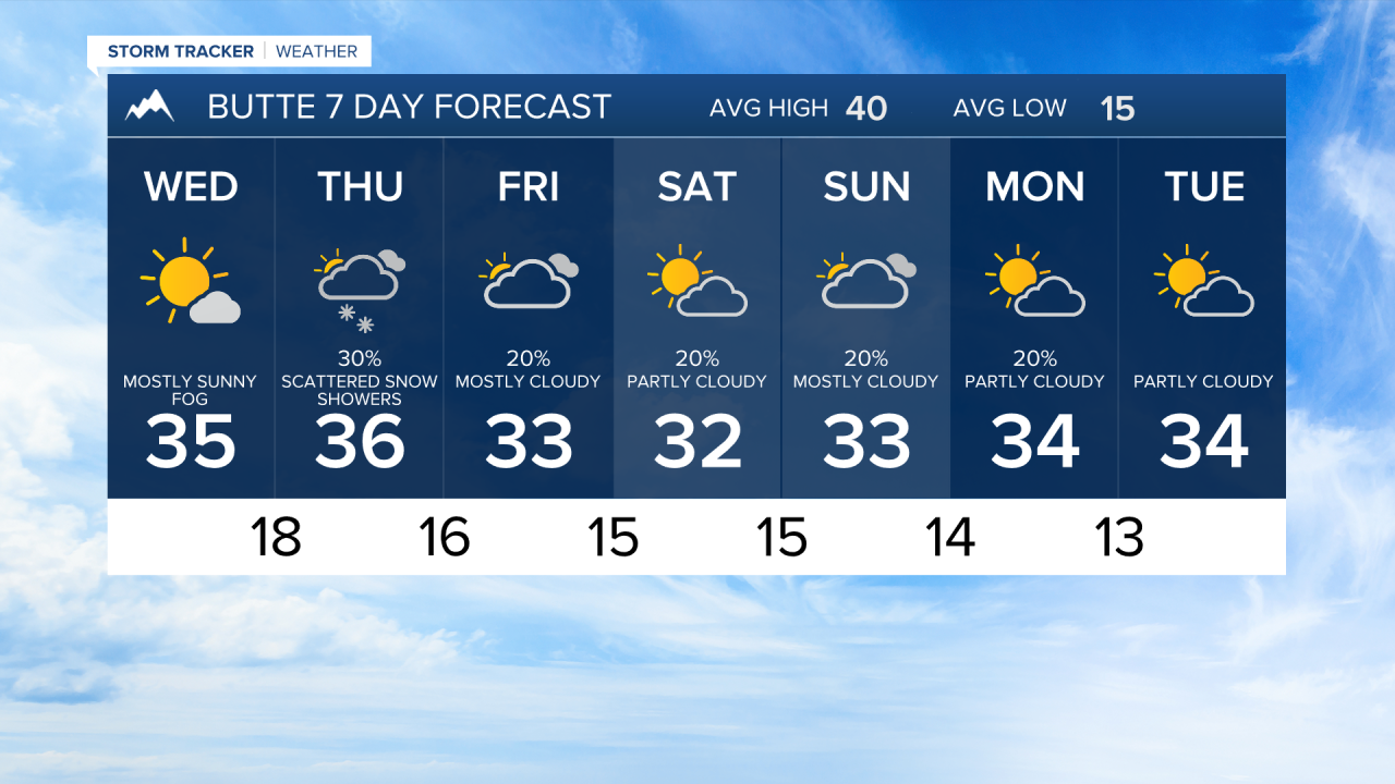
The advisory lifts Wednesday morning, and skies clear out nicely through the day with highs only reaching the mid-30s, still running about 4 degrees below the seasonal average. Bitter cold continues through the 48-hour window, with wind chills holding in the teens into Wednesday night.
No meaningful precipitation is in the picture for the next two days, but any snow on the ground will stick around in those temperatures. The extended pattern keeps highs running 4 to 5 degrees below normal Friday through the weekend, with temperatures struggling to reach the low-to-mid 30s.
The active Pacific storm track stays focused well to the south, with the best snow chances through the week staying north toward the Flathead Valley and Glacier Park rather than targeting Butte directly.
