

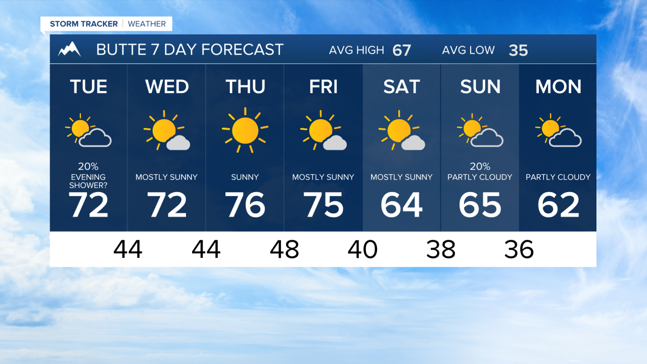


BUTTE — Highs climb into the lower to mid 70s over the next few days, sitting roughly 7 to 11 degrees above average, then slide back to the lower 60s by the end of the week, right near seasonal norms. If you have outdoor plans like yard work, hiking, or a backyard event, front-load them toward midweek when conditions are warmest and dry, then plan for a more typical fall feel as the weekend approaches.
MONDAY NIGHT
Tonight stays clear and comfortable, with lows dipping into the low 40s, so grab a jacket if you're heading out after dark. Tuesday morning looks partly cloudy and mild, warming back into the lower 70s by the afternoon.
TUESDAY
The main story for Tuesday is a chance of showers arriving in the evening. A low pressure system tracking from northern Nevada into southeast Idaho will push some moisture our way, bringing about a 40% chance of rain after sunset with just a few hundredths of an inch expected. Wind gusts to around 30 mph and some lightning are also possible with any storms that develop.
WEDNESDAY AND THURSDAY
Wednesday and Thursday bring sunshine and highs climbing from the low 70s to the mid-70s, running a solid 7 to 11 degrees above the seasonal average for this time of year.
FRIDAY
Friday stays warm in the mid-70s before a cold front arrives, bringing gusty southerly winds and another chance of showers or thunderstorms.
SATURDAY AND SUNDAY
The pattern then flips dramatically over the weekend: highs drop to the low 60s Saturday and Sunday, right near or even slightly below normal, and with overnight lows falling into the upper 30s, frost is a real possibility by Saturday night into early next week.
