

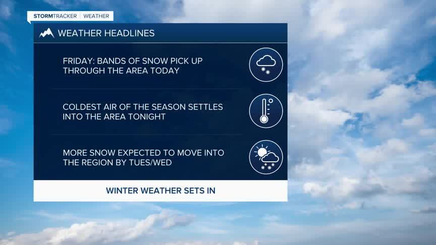
Today's Forecast: Winter Storm Warnings and Winter Weather Advisories are in effect for SW Montana for your Friday as we see colder weather sink into the area with bands of heavy snow likely through the afternoon and early evening.Travel could be difficult by the afternoon on Friday with near-zero visibility likely.Temperatures will fall quickly from the 30s down to the teens.
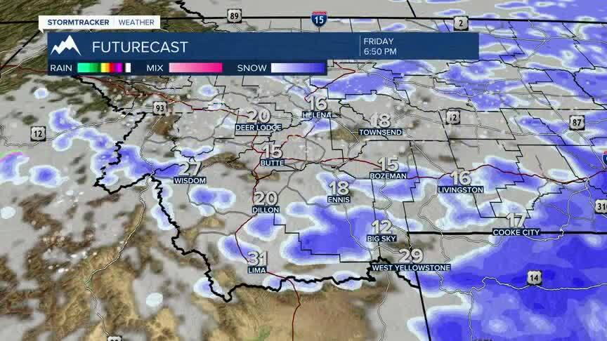
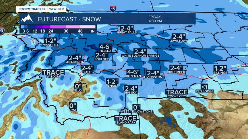
BOZEMAN: High: 34; Low: 1. Banding of snow with highs falling from the low 30s in the late morning to the teens in the afternoon.Snow amounts are expected to be 4”-6” with some locally higher amounts. Winds are expected to gust to near 25 mph out of the northwest which is expected to drop visibility significantly at times.
BUTTE: High: 32; Low: -1. Snow showers for the late morning and early afternoon.Snow amounts expected to be in the 1”-3” range with gusty winds and falling temperatures through the afternoon.
DILLON: High: 43; Low: 8. Snow is likely for mid-afternoon today with winds gusting near 25 mph.Snow accumulations expected to be less than 1” for today but visibility will be low with gusty winds as the snow moves in.
WEST YELLOWSTONE: High: 36; Low: -1. Snow is expected during the afternoon.Daytime accumulation is expected to be less than 1” with additional light snow expected through the early evening.
TRAVEL CONCERNS FRIDAY AND THE WEEKEND
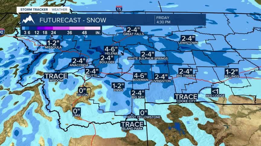
Our first real bout with winter weather is settling into the area Friday into the weekend.Bands of heavy snow will snarl traffic in the area with 4”-6” of snow expected in Bozeman and 1”-3” possible in Butte.An arctic cold front will bring the snow from late morning into the afternoon and early evening on Friday.Travel for area passes could be difficult through the early evening.
Behind the front will be much colder air.Lows tonight are expected to be near zero which will lock us into very cold temperatures through the weekend.Highs this weekend, despite plenty of sunshine will only be in the low 20s Saturday and Sunday.Roads in the region will be slow to clear in most instances and could stay slick into Saturday afternoon.
